By David Shepardson, Jasper Ward
WASHINGTON (Reuters) -The National Transportation Safety Board said on Monday it has completed interviews with air traffic controllers in its investigation into the collision last week between an American Airlines regional passenger jet and a U.S.
Army helicopter over the Potomac River in Washington that killed 67 people.
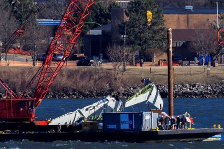
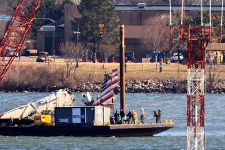
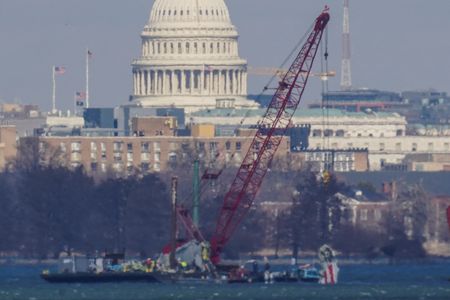
The salvage team on Tuesday recovered part of the fuselage and right engine of the Bombardier CRJ-700 passenger jet and will retrieve the Sikorsky UH-60 Black Hawk after the airplane has been recovered.
The NTSB said it has obtained training and flight logs for both flight crews and maintenance records for both aircraft and is building histories for both flight crews.
The collision occurred on Wednesday night.
Additional radar data will be released on Tuesday as investigators work to complete a more precise picture of what happened, NTSB Chair Jennifer Homendy told Reuters.
“We have much more granular data from Potomac TRACON that we’re going to be able to release,” Homendy said, referring to a Federal Aviation Administration terminal radar approach facility in Virginia.
The Washington, D.C., fire department said on Sunday that officials had identified 55 of the 67 people killed in the collision.
Additional human remains have been recovered but not identified, the department said on Monday. Those and additional remains are still in the process of being identified by the medical examiner’s office.
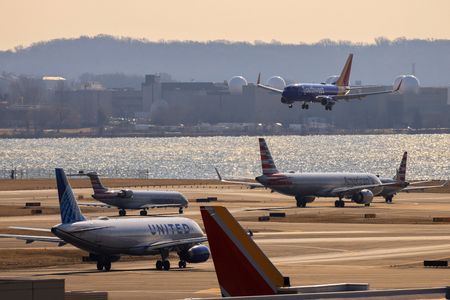
Wreckage is being moved to Hangar 7 at Ronald Reagan Washington National Airport.
Much of the Potomac River remains restricted to authorized vessels. Two of the lesser-used runways at the airport remain closed.
Homendy said the NTSB also plans to look at prior near-miss incidents between helicopters and airplanes around Washington Reagan and could expand the investigation “to other areas where there’s military helicopter and air traffic.”
Homendy said the NTSB is also conducting interviews with American Airlines and the U.S.
Army.
“We’re going to have to understand what are standard operating procedures” for a helicopter training mission, she said.
Investigators from the NTSB said on Saturday they had determined that the CRJ-700 airplane that had departed Wichita, Kansas, was at 325 feet (99 meters), plus or minus 25 feet, at the time of impact.
The detail suggests that the Army Black Hawk helicopter was flying above 200 feet (61 meters), the maximum altitude for the route it was using.
Homendy said that data was from DC radar which updates every 5 seconds, and “that can change in a quick period of time when the helicopter is moving at a good speed.”
Data confirmed that the air traffic controller alerted the helicopter to the presence of the CRJ-700 about 2 minutes before the collision.
Meanwhile, relatives of some of the victims visited the edge of the river near the crash site on Sunday.
(Reporting by Jasper Ward and David Shepardson in Washington; Editing by Susan Heavey, Mark Porter and Matthew Lewis)